top of page
2025 Projects

Estimating the balance of competition, facilitation, and parasitism between sandalwood and koa in a Hawaiian-restored tropical dry forests
2024 Projects

Crown allometry models for estimating growing space requirements and leaf area index of Eucalyptus urophylla in East Nusa Tenggara
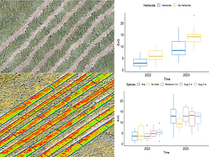
Monitoring the dynamics of invasive species (Ulex europaeus) re-growth after vegetation management using unmanned aerial vehicle

Integrating annotation and segmentation in Mask R-CNN algorithm for improving the accuracy of animal species recognition (Bos javanicus) using unmanned aerial vehicle
2023 Projects
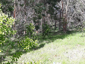
Mixed stands management between sandalwood and host plants in Hawaiian tropical dry forests
2022 Projects

Predicting wood production and carbon storage of community forest stands using Unmanned Aerial Vehicles
2021 Projects
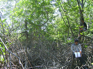
Long-term effects of reforestation on plant-animal diversity, carbon storage, and energy stock in restored mangrove ecosystems
2020 Projects
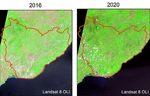
Estimating biomass production, carbon sequestration, and energy storage of Eucalyptus urophylla stand in dryland ecosystem

Projecting the optimum host-to-sandalwood ratio for balancing competition, facilitation, and parasitism in undergoing restoration in Hawaiian ecosystems

The potential use of Sentinel-2A imagery for monitoring the dynamics of flood disaster vulnerability in the northern coastal area of Java Island
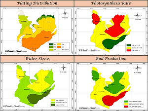
Integrating case-based reasoning method and unmanned aerial vehicles for estimating water stress, photosynthesis, and bud production in clove plantation

Improving sustainable Hawaiian sandalwood (Santalum paniculatum) silviculture and endemic species conservation (Acacia koa and Dodonaea viscosa) with mixed stand management

Mata Banteng: Integrated precision forestry systems for monitoring wildlife and illegal logging in Baluran National Park

Developing allometric models for estimating energy stock of community forest tree species in Jepara District

Cajuput agroforestry development for improving sustainable non-timber forest products, stabilizing food supply, and reducing poverty

Biodiversity monitoring in secondary tropical rainforest ecosystems using a hybrid remote sensing approach

Developing pollinator technology using unmanned aerial vehicles for supporting artificial pollination in a commercial oil palm plantation at the ultramafic ecosystems

Investigating the impact of abandoned land on soil degradation, carbon emissions, and biodiversity loss post-Merapi eruption using Sentinel-2A

Energy storage estimation by allometric equations for Indonesian community forest tree species in supporting biomass co-fairing scheme in power plant

Unmanned aerial vehicle for estimating stand biodiversity, carbon sequestration, and firewood production of community woodlots in Indonesian coastal area

Estimating fishpond productivity and plankton densities using Sentinel-2A imagery in Gresik District
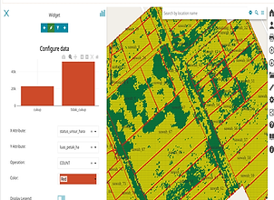
PreciRice: Integrated web apps for determining nutrient management in agricultural land based on Unmanned Aerial Vehicles

Unmanned aerial vehicles using multi-spectral sensor for estimating soil nutrient status in agricultural land
bottom of page